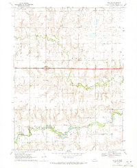
1969 Map of Utica SW
USGS Topo · Published 1971About this map
The West Fork Big Blue River and its tributary Antelope Creek anchor the southern landscape of this 1969 survey, where York County's agrarian character is mapped in detail. The region is defined by a dense network of watercourses, including Beaver Creek and the meandering Dry Run, which cut through the fertile plains of Leroy, Beaver, and Mc Fadden townships. A corridor for modern travel, the Interstate 80 highway bisects the central prairie, providing a stark contrast to the scattered landmarks of rural life.
Find a feature on this map
20 named features on this map. Tap any name to fly to it.
Don’t see what you’re looking for? This feature index may not catch every label — zoom into the map to look around manually.
Map Details
Editions of this 1969 Utica SW Map
This is the sole edition of this map. No revisions or reprints were ever made.
Other maps of this area

1898 · York
USGS Topo · 1:125,000

1899 · York
USGS Topo · 1:125,000

1934 · Utica
USGS Topo · 1:62,500

1937 · Utica
USGS Topo · 1:62,500

1955 · Lincoln
USGS Topo · 1:250,000

1957 · Lincoln
USGS Topo · 1:250,000

1958 · Lincoln
USGS Topo · 1:250,000
1966 · Friend
USGS Topo · 1:24,000
1966 · Beaver Crossing
USGS Topo · 1:24,000
1966 · Utica
USGS Topo · 1:24,000