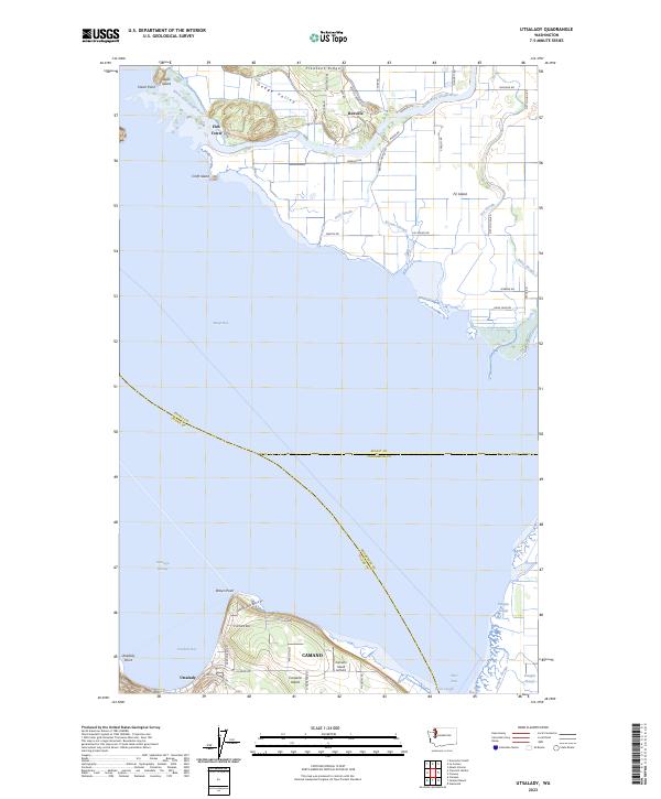
2023 Map of Utsalady
USGS Topo · Published 2023About this map
Skagit Bay sits at the center of this coastal landscape, where the North Fork Skagit River breaks into a complex delta network. The map reveals the intricate water systems of Fir Island, defined by numerous channels including Hall Slough, Browns Slough, and Dry Slough. These waterways carve through the low-lying agricultural lands of the Skagit delta, punctuated by small settlements like Rexville and Fish Town.
Find a feature on this map
63 named features on this map. Tap any name to fly to it.
Don’t see what you’re looking for? This feature index may not catch every label — zoom into the map to look around manually.
Map Details
Editions of this 2023 Utsalady Map
This is the sole edition of this map. No revisions or reprints were ever made.
Other maps of this area

1911 · Mount Vernon
USGS Topo · 1:125,000

1939 · Coupeville
USGS Topo · 1:62,500

1940 · Mt Vernon
USGS Topo · 1:62,500

1943 · Mt Vernon
USGS Topo · 1:62,500

1943 · Stanwood
USGS Topo · 1:62,500

1943 · Deception Pass
USGS Topo · 1:62,500

1951 · Deception Pass
USGS Topo · 1:62,500

1953 · Camano
USGS Topo · 1:24,000
1956 · Stanwood
USGS Topo · 1:24,000
1956 · Utsalady
USGS Topo · 1:24,000