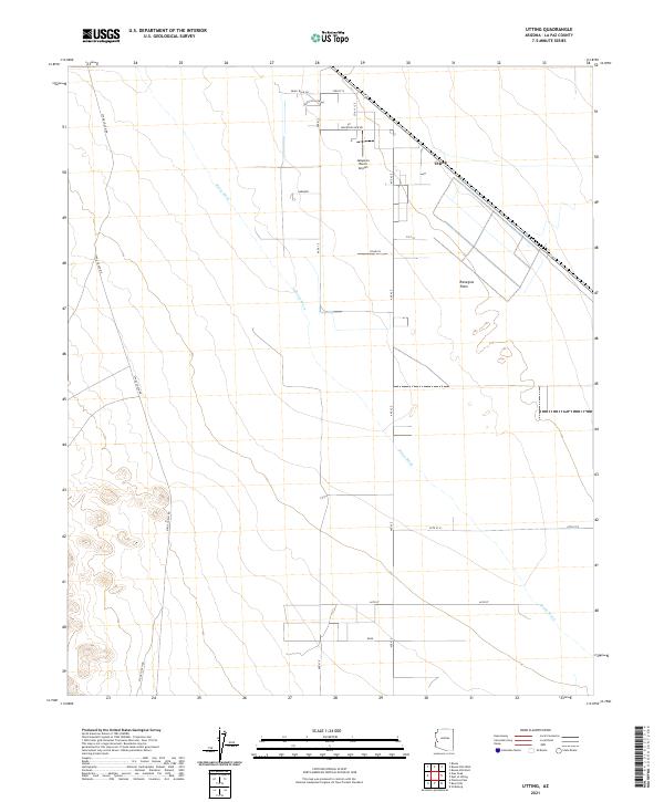
2021 Map of Utting
USGS Topo · Published 2021About this map
Ranegras Plain dominates this portion of La Paz County, where the desert landscape is defined by the ephemeral drainage of Bouse Wash. The settlement of Utting is centered around a diagonal transportation corridor, supported by local infrastructure like the Jalapeno Ranch Airport and a small grid of rural residential roads including Solar Ln and Mountain View Rd. To the west, Stage Coach Rd skirts the rising terrain at the edge of the plain, tracing a path through the townships of t6n r17w and t5n r17w. The map reflects a modern rural Arizona desert character, where large-scale land divisions and named ranches like Gardner stand out against the open alluvial flats.
Find a feature on this map
22 named features on this map. Tap any name to fly to it.
Don’t see what you’re looking for? This feature index may not catch every label — zoom into the map to look around manually.
Map Details
Editions of this 2021 Utting Map
This is the sole edition of this map. No revisions or reprints were ever made.
Other maps of this area

1930 · Linskey
USGS Topo · 1:62,500

1942 · Blythe
USGS Topo · 1:250,000

1942 · Vicksburg
USGS Topo · 1:250,000

1954 · Salton Sea
USGS Topo · 1:250,000

1954 · Phoenix
USGS Topo · 1:250,000

1955 · Salton Sea
USGS Topo · 1:250,000

1957 · Phoenix
USGS Topo · 1:250,000

1958 · Phoenix
USGS Topo · 1:250,000

1959 · Salton Sea
USGS Topo · 1:250,000

1960 · Phoenix
USGS Topo · 1:250,000