
1898 Map of Uvalde
USGS Topo · Published 1898About this map
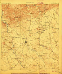
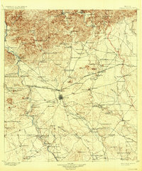
The town of Uvalde serves as the central hub of this late-nineteenth-century landscape, positioned at a critical junction of the Southern Pacific and the Galveston Harrisburg and San Antonio railroads. The area is defined by a dense network of family-held ranching estates such as Molesworth Ranch, Davenport Ranch, and Hackberry Ranch, reflecting the region’s deep cattle and livestock roots. The hydrology of the Frio River and Nueces River systems is vital here, with landmarks like Eightmile Waterhole and Black Waterhole providing essential water sources in a semi-arid environment.
Find a feature on this map
124 named features on this map. Tap any name to fly to it.
Don’t see what you’re looking for? This feature index may not catch every label — zoom into the map to look around manually.
Map Details
Editions of this 1898 Uvalde Map
3 editions found
Other maps of this area

1893 · Nueces
USGS Topo · 1:125,000

1896 · Nueces
USGS Topo · 1:125,000

1896 · Brackett
USGS Topo · 1:125,000

1897 · Brackett
USGS Topo · 1:125,000

1899 · Uvalde
USGS Topo · 1:125,000

1928 · Frio Town
USGS Topo · 1:62,500

1938 · Turkey Mountain
USGS Topo · 1:48,000

1939 · La Pryor
USGS Topo · 1:62,500

1940 · Chacon Creek
USGS Topo · 1:62,500

1942 · Divot
USGS Topo · 1:62,500