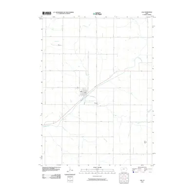
2010 Map of Vail
USGS Topo · Published 2010About this map
Vail serves as the central hub for this Crawford County landscape, where the East Boyer River and a network of creeks define the drainage patterns of the western Iowa prairie. The settlement’s civic core is anchored by the Vail Post Office, while its local history is preserved across several burial grounds including King Cemetery, Vail Cemetery, and Saint Anns Cemetery. The surrounding countryside is organized by a precise grid of roads, such as 350th St and L Ave, which navigate the gentle valleys of King Creek and Miller Creek. A unique modern landmark, the Lenz Landing Strip, appears in the southeast, contrasting with the established agricultural land-use patterns. This survey illustrates the relationship between these small-town centers and the waterways like Rocky Run and Hay Creek that historically dictated the placement of early farms and transport routes.
Find a feature on this map
30 named features on this map. Tap any name to fly to it.
Don’t see what you’re looking for? This feature index may not catch every label — zoom into the map to look around manually.
Map Details
Editions of this 2010 Vail Map
This is the sole edition of this map. No revisions or reprints were ever made.
Other maps of this area

1954 · Omaha
USGS Topo · 1:250,000

1954 · Fort Dodge
USGS Topo · 1:250,000

1957 · Omaha
USGS Topo · 1:250,000

1957 · Fort Dodge
USGS Topo · 1:250,000

1958 · Omaha
USGS Topo · 1:250,000

1958 · Fort Dodge
USGS Topo · 1:250,000

1971 · Earling NE
USGS Topo · 1:24,000

1971 · Denison
USGS Topo · 1:24,000

1971 · Kiron
USGS Topo · 1:24,000

1978 · Manilla
USGS Topo · 1:24,000