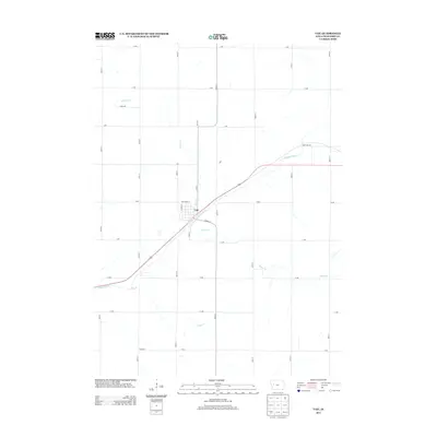
2013 Map of Vail
USGS Topo · Published 2013About this map
Vail sits at the center of this Crawford County landscape, where the E Boyer River carves a diagonal path through the agricultural heartland of western Iowa. The settlement is defined by its grid of local streets like Hunterdon St and Warren St, surrounded by a vast network of section roads that partition the terrain into productive farm plots. This drainage system is particularly well-defined on this sheet, with several tributaries feeding the main valley. King Cr and Rocky Run enter from the north, while Hay Cr and Miller Cr drain the southern sections. This network of waterways and the accompanying road grid reveal the enduring rural structure of the region, illustrating how the natural topography of the Boyer River valley shaped the development of local transit and settlement patterns in the early 21st century.
Find a feature on this map
30 named features on this map. Tap any name to fly to it.
Don’t see what you’re looking for? This feature index may not catch every label — zoom into the map to look around manually.
Map Details
Editions of this 2013 Vail Map
This is the sole edition of this map. No revisions or reprints were ever made.
Other maps of this area

1954 · Omaha
USGS Topo · 1:250,000

1954 · Fort Dodge
USGS Topo · 1:250,000

1957 · Omaha
USGS Topo · 1:250,000

1957 · Fort Dodge
USGS Topo · 1:250,000

1958 · Omaha
USGS Topo · 1:250,000

1958 · Fort Dodge
USGS Topo · 1:250,000

1971 · Earling NE
USGS Topo · 1:24,000

1971 · Denison
USGS Topo · 1:24,000

1971 · Kiron
USGS Topo · 1:24,000

1978 · Manilla
USGS Topo · 1:24,000