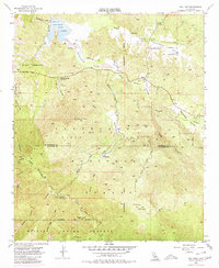
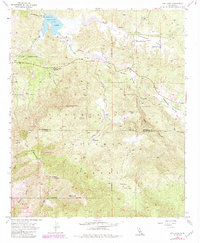
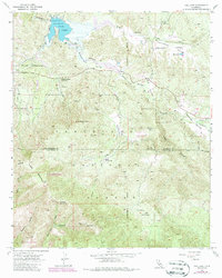
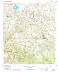
1953 Map of Vail Lake
USGS Topo · Published 1980About this map
Vail Lake dominates the northern reaches of this mid-century landscape, a significant reservoir on Temecula Creek that fundamentally altered the local drainage patterns. To the south, the topography transitions into the steep, high-elevation terrain of Agua Tibia Mountain, where the Mission Indian Reserve and the Wilderness Area Boundary delineate protected lands. This 1953 survey captures the rural infrastructure of the era, including the Dripping Springs Guard Sta and the Cottonwood School in Lancaster Valley. A network of rugged access routes, such as the Crosley Truck Trail and Palomar Divide Truck Trail, provides a clear view of how forest management and backcountry travel were conducted before modern development. Notable historical markers like the Crosley Homestead and the Cemetery near Radec offer tangible connection points for genealogists and local historians studying the early settlement of the Riverside and San Diego county lines.
Find a feature on this map
45 named features on this map. Tap any name to fly to it.
Don’t see what you’re looking for? This feature index may not catch every label — zoom into the map to look around manually.
Map Details
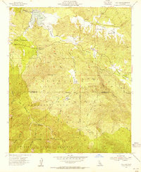
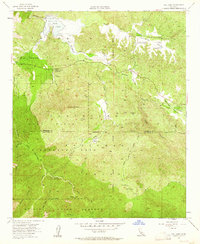
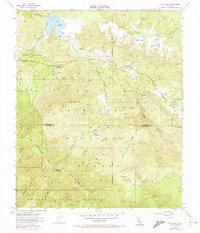
Editions of this 1953 Vail Lake Map
7 editions found
Other maps of this area

1901 · Southern California Sheet No. 1
USGS Topo · 1:250,000

1901 · San Jacinto
USGS Topo · 1:125,000

1901 · Elsinore
USGS Topo · 1:125,000

1901 · San Luis Rey
USGS Topo · 1:125,000

1903 · Ramona
USGS Topo · 1:125,000

1904 · Southern California Sheet No. 2
USGS Topo · 1:250,000

1904 · Southern California Sheet No. 1
USGS Topo · 1:250,000

1939 · Palomar Mountain
USGS Topo · 1:62,500

1942 · Temecula
USGS Topo · 1:62,500

1942 · Hemet
USGS Topo · 1:62,500