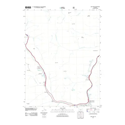
2011 Map of Vail Pass
USGS Topo · Published 2011About this map
Wheeler Junction serves as a focal point in this high-altitude landscape, where the confluence of Tenmile Creek and West Tenmile Creek meets the modern path of Interstate 70. The map documents the complex infrastructure required to traverse the Continental Divide region, featuring the Vail Pass - Tenmile route and the steep gradients of Vail Pass. Industrial history is noted through the Vail Pass Mine and Eagle Number One Mine, while recreational development is evident at the Black Lakes Campground and surrounding water bodies like Black Lake Number 2 and Officers Gulch Pond. The terrain is defined by a series of named peaks and passes, including Buffalo Mountain, Uneva Peak, and Red Buffalo Pass, which dictate the drainage patterns of Gore Creek and its many tributaries. This survey captures the intersection of heavy transit corridors and mountain wilderness at the start of the 21st century.
Find a feature on this map
44 named features on this map. Tap any name to fly to it.
Don’t see what you’re looking for? This feature index may not catch every label — zoom into the map to look around manually.
Map Details
Editions of this 2011 Vail Pass Map
This is the sole edition of this map. No revisions or reprints were ever made.
Other maps of this area

1889 · Leadville
USGS Topo · 1:125,000

1891 · Leadville
USGS Topo · 1:125,000

1929 · Dillon
USGS Topo · 1:62,500

1934 · Climax
USGS Topo · 1:48,000

1934 · Minturn
USGS Topo · 1:62,500

1934 · Dillon
USGS Topo · 1:62,500

1938 · Mt. Lincoln
USGS Topo · 1:48,000

1942 · Leadville
USGS Topo · 1:125,000

1945 · Mount Lincoln
USGS Topo · 1:62,500

1949 · Holy Cross
USGS Topo · 1:62,500