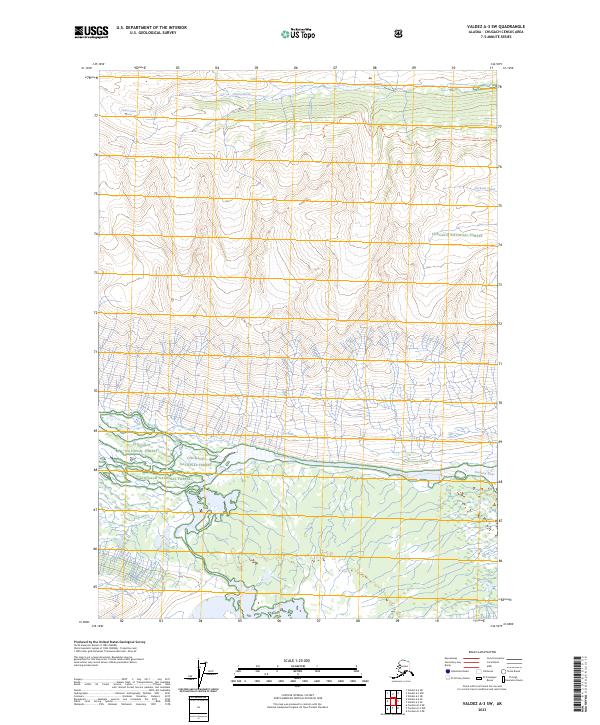
2023 Map of Valdez A-3 SW
USGS Topo · Published 2023About this map
The Chugach National Forest encompasses this high-altitude landscape, where the Tasnuna River flows through the southern portion of the quadrangle. The map is defined by extreme elevation changes, anchored by the Cleave Creek Glacier in the northwest. This ice field feeds Cleave Creek, which drains northward, while the Jackson Creek system cuts through the eastern sections. A solitary managed path, the Jackson Creek Trl, offers the only indicated route through the steep northern terrain. The layout of these water bodies and glaciers illustrates the complex drainage patterns of the Chugach Mountains, where glacial meltwater contributes directly to the river systems that have shaped these valleys over centuries.
Find a feature on this map
11 named features on this map. Tap any name to fly to it.
Don’t see what you’re looking for? This feature index may not catch every label — zoom into the map to look around manually.
Map Details
Editions of this 2023 Valdez A-3 SW Map
This is the sole edition of this map. No revisions or reprints were ever made.
Other maps of this area

1948 · Cordova
USGS Topo · 1:250,000

1950 · Valdez A-3
USGS Topo · 1:63,360

1950 · Cordova D-3
USGS Topo · 1:63,360

1951 · Cordova
USGS Topo · 1:250,000

1951 · Cordova D-4
USGS Topo · 1:63,360

1952 · Valdez
USGS Topo · 1:250,000

1953 · Cordova D-4
USGS Topo · 1:63,360

1953 · Cordova D-3
USGS Topo · 1:63,360

1953 · Valdez A-4
USGS Topo · 1:63,360

1953 · Valdez A-3
USGS Topo · 1:63,360