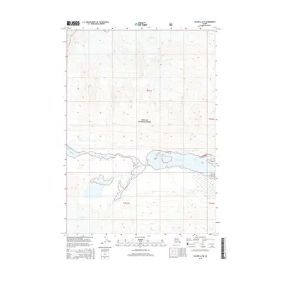
2016 Map of Valdez A-4 SE
USGS Topo · Published 2016About this map
Tasnuna River flows through the heart of this Alaskan landscape, cutting a wide alluvial valley between massive ice fields and high peaks. This 2016 survey documents the shifting margins of the Woodworth Glacier to the south and the Cleave Cr Glacier in the north, providing a detailed record of the glacial hydrology within the Chugach National Forest. The map illustrates the braided nature of the water systems here, where the river's path is defined by glacial melt and sediment discharge. It offers a precise look at the remote wilderness of the Unorganized Borough, where traditional township and range lines like t9s r1e and t10s r1e overlay a terrain dominated entirely by ice and moving water.
Find a feature on this map
8 named features on this map. Tap any name to fly to it.
Don’t see what you’re looking for? This feature index may not catch every label — zoom into the map to look around manually.
Map Details
Editions of this 2016 Valdez A-4 SE Map
This is the sole edition of this map. No revisions or reprints were ever made.
Other maps of this area

1948 · Cordova
USGS Topo · 1:250,000

1950 · Valdez A-3
USGS Topo · 1:63,360

1950 · Cordova D-3
USGS Topo · 1:63,360

1951 · Cordova
USGS Topo · 1:250,000

1951 · Cordova D-4
USGS Topo · 1:63,360

1952 · Valdez
USGS Topo · 1:250,000

1953 · Cordova D-4
USGS Topo · 1:63,360

1953 · Cordova D-3
USGS Topo · 1:63,360

1953 · Valdez A-4
USGS Topo · 1:63,360

1953 · Valdez A-3
USGS Topo · 1:63,360