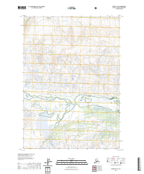
2023 Map of Valdez A-4 SE
USGS Topo · Published 2023About this map
Chugach National Forest encompasses much of this landscape, dominated by the dynamic movement of ice and glacial runoff. The northern reaches are defined by the Cleave Creek Glacier, which feeds a complex network of streams and braided channels. These waters eventually consolidate into the Tasnuna River, which flows through a wide valley in the southern portion of the sheet. This 2023 survey illustrates the dramatic elevation changes and the specific drainage patterns that shape this corner of Alaska. The map provides a contemporary record of these glacial features and river systems, showing how the natural geography remains the primary feature in a region without permanent settlements or road infrastructure.
Find a feature on this map
10 named features on this map. Tap any name to fly to it.
Don’t see what you’re looking for? This feature index may not catch every label — zoom into the map to look around manually.
Map Details
Editions of this 2023 Valdez A-4 SE Map
This is the sole edition of this map. No revisions or reprints were ever made.
Other maps of this area

1948 · Cordova
USGS Topo · 1:250,000

1950 · Valdez A-3
USGS Topo · 1:63,360

1950 · Cordova D-3
USGS Topo · 1:63,360

1951 · Cordova
USGS Topo · 1:250,000

1951 · Cordova D-4
USGS Topo · 1:63,360

1952 · Valdez
USGS Topo · 1:250,000

1953 · Cordova D-4
USGS Topo · 1:63,360

1953 · Cordova D-3
USGS Topo · 1:63,360

1953 · Valdez A-4
USGS Topo · 1:63,360

1953 · Valdez A-3
USGS Topo · 1:63,360