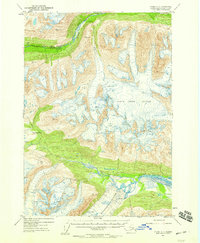
1953 Map of Valdez A-4
USGS Topo · Published 1959About this map
Richardson Highway cuts through the northern mountains of this 1950s interior landscape, following the valley of the Tiekel River. This corridor represents a vital transportation link in a region dominated by glacial movement and extreme vertical relief. To the south, the massive Cleave Creek Glacier and Woodworth Glacier dominate the terrain, their blue-tinted contours indicating the massive scale of the ice fields feeding into the Tasnuna River.
Find a feature on this map
16 named features on this map. Tap any name to fly to it.
Don’t see what you’re looking for? This feature index may not catch every label — zoom into the map to look around manually.
Map Details
Editions of this 1953 Valdez A-4 Map
3 editions found

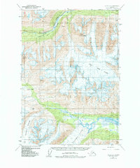
Other maps of this area

1948 · Cordova
USGS Topo · 1:250,000

1950 · Valdez A-3
USGS Topo · 1:63,360

1950 · Cordova D-3
USGS Topo · 1:63,360

1950 · Cordova D-5
USGS Topo · 1:63,360

1951 · Cordova
USGS Topo · 1:250,000

1951 · Valdez B-3
USGS Topo · 1:63,360

1951 · Valdez B-5
USGS Topo · 1:63,360

1951 · Valdez B-4
USGS Topo · 1:63,360

1951 · Cordova D-4
USGS Topo · 1:63,360

1952 · Valdez
USGS Topo · 1:250,000