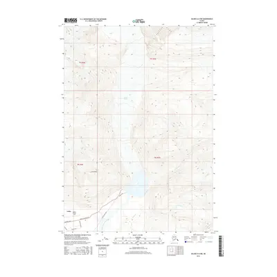
2016 Map of Valdez A-6 NW
USGS Topo · Published 2016About this map
The massive Valdez Glacier dominates the northern landscape of this region, its meltwaters feeding the complex braiding of the Valdez Glacier Stream as it flows toward the coast. In the southern portion of the sheet, the modern infrastructure of Valdez begins to take shape, anchored by aviation and industrial access. Valdez Pioneer Field serves as a central landmark for the area, connected by a network of specialized routes including Airport Road and the Glacier Haul Road. The transition from the high elevations of West Peak down to the drainage basins of Camicia Cr and Slater Cr illustrates the dynamic glacial environment and the specific ways transportation has been engineered to navigate this active Alaskan terrain.
Find a feature on this map
17 named features on this map. Tap any name to fly to it.
Don’t see what you’re looking for? This feature index may not catch every label — zoom into the map to look around manually.
Map Details
Editions of this 2016 Valdez A-6 NW Map
This is the sole edition of this map. No revisions or reprints were ever made.
Other maps of this area

1951 · Valdez B-6
USGS Topo · 1:63,360

1951 · Valdez A-6
USGS Topo · 1:63,360

1952 · Valdez
USGS Topo · 1:250,000

1952 · Valdez A-6
USGS Topo · 1:63,360

1953 · Valdez B-6
USGS Topo · 1:63,360

1960 · Valdez B-7
USGS Topo · 1:63,360

1960 · Valdez A-7
USGS Topo · 1:63,360

1960 · Valdez
USGS Topo · 1:250,000
1983 · Valdez A-6 SW
USGS Topo · 1:25,000
1983 · Valdez A-7 SE
USGS Topo · 1:25,000