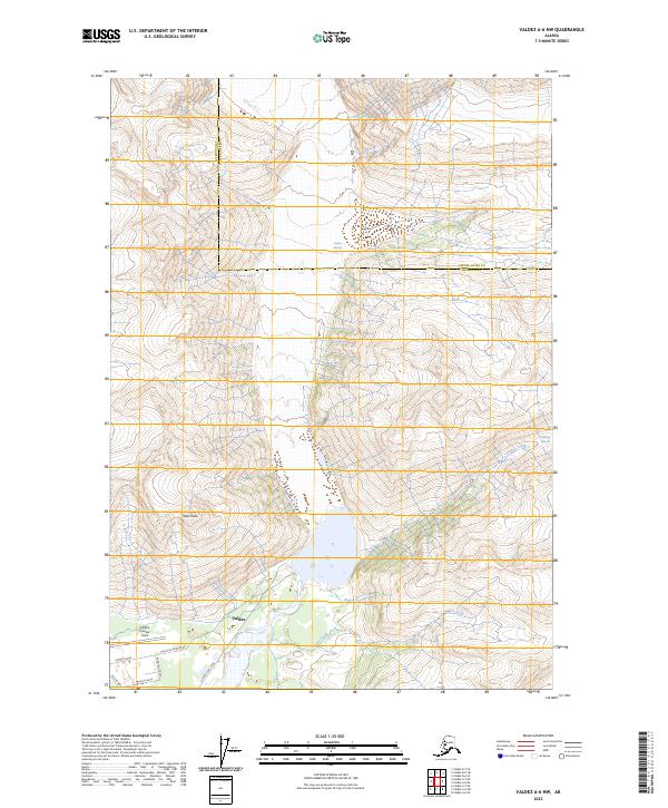
2023 Map of Valdez A-6 NW
USGS Topo · Published 2023About this map
Valdez serves as the focal point of this northern coastal environment, where the infrastructure of a modern Alaskan port meets the massive ice of the Chugach Mountains. The map illustrates the town's expansion toward the northeast, dominated by the aeronautical facilities at Valdez Pioneer Field. This area is defined by its transition from the built environment to the glacial wilderness, connected by specialized routes such as the Glacier Haul Road and Valdez Glacier Road.
Find a feature on this map
20 named features on this map. Tap any name to fly to it.
Don’t see what you’re looking for? This feature index may not catch every label — zoom into the map to look around manually.
Map Details
Editions of this 2023 Valdez A-6 NW Map
This is the sole edition of this map. No revisions or reprints were ever made.
Other maps of this area

1951 · Valdez B-6
USGS Topo · 1:63,360

1951 · Valdez A-6
USGS Topo · 1:63,360

1952 · Valdez
USGS Topo · 1:250,000

1952 · Valdez A-6
USGS Topo · 1:63,360

1953 · Valdez B-6
USGS Topo · 1:63,360

1960 · Valdez B-7
USGS Topo · 1:63,360

1960 · Valdez A-7
USGS Topo · 1:63,360

1960 · Valdez
USGS Topo · 1:250,000
1983 · Valdez A-6 SW
USGS Topo · 1:25,000
1983 · Valdez A-7 SE
USGS Topo · 1:25,000