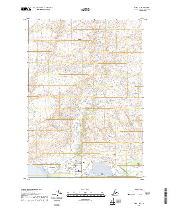
2023 Map of Valdez A-7 NE
USGS Topo · Published 2023About this map
Valdez sits at the base of the dramatic Chugach Mountains, where glacial meltwater and mountain streams converge at the head of the fjord. This 2023 survey details the modern layout of the city, showing a grid of residential and commercial streets including Egan Drive and Hazelet Avenue. The landscape is dominated by ice and water, from the massive Shoup Glacier and Johnson Glacier in the north to the sediment-rich outflow of Mineral Creek. Significant civic landmarks include the Valdez Courthouse and the Prince William Sound Community College campus.
Find a feature on this map
39 named features on this map. Tap any name to fly to it.
Don’t see what you’re looking for? This feature index may not catch every label — zoom into the map to look around manually.
Map Details
Editions of this 2023 Valdez A-7 NE Map
This is the sole edition of this map. No revisions or reprints were ever made.
Other maps of this area

1951 · Valdez B-6
USGS Topo · 1:63,360

1951 · Valdez A-6
USGS Topo · 1:63,360

1952 · Valdez
USGS Topo · 1:250,000

1952 · Valdez A-6
USGS Topo · 1:63,360

1953 · Valdez B-6
USGS Topo · 1:63,360

1960 · Valdez B-7
USGS Topo · 1:63,360

1960 · Valdez A-7
USGS Topo · 1:63,360

1960 · Valdez
USGS Topo · 1:250,000
1983 · Valdez A-6 SW
USGS Topo · 1:25,000
1983 · Valdez A-7 SE
USGS Topo · 1:25,000