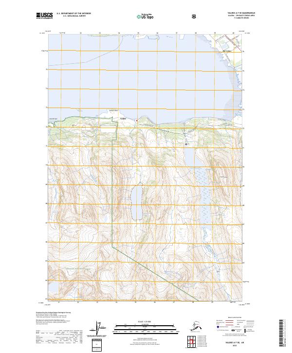
2023 Map of Valdez A-7 SE
USGS Topo · Published 2023About this map
Valdez and the historic site of Old Valdez anchor this coastal landscape where industrial infrastructure meets the steep peaks of the Chugach National Forest. The modern energy economy is clearly traced via the Alaska Pipeline, which winds along the shoreline and through the mountains near Jackson Point. The transition from the old townsite to the current city is reflected in the road network, including the Richardson Highway and local streets like Sawmill Drive. High-altitude features like Sugarloaf Mtn overlook significant water bodies and drainage systems, most notably Solomon Lake and the steep descents of Solomon Gulch and Abercrombie Gulch. From the tidal flats of Sawmill Spit to the interior mountain ranges, the map documents a vital corridor of Alaskan transport and utility networks.
Find a feature on this map
26 named features on this map. Tap any name to fly to it.
Don’t see what you’re looking for? This feature index may not catch every label — zoom into the map to look around manually.
Map Details
Editions of this 2023 Valdez A-7 SE Map
This is the sole edition of this map. No revisions or reprints were ever made.
Other maps of this area

1948 · Cordova
USGS Topo · 1:250,000

1950 · Cordova D-7
USGS Topo · 1:63,360

1951 · Cordova
USGS Topo · 1:250,000

1951 · Cordova D-6
USGS Topo · 1:63,360

1951 · Valdez A-6
USGS Topo · 1:63,360

1952 · Valdez
USGS Topo · 1:250,000

1952 · Cordova D-7
USGS Topo · 1:63,360

1952 · Valdez A-6
USGS Topo · 1:63,360

1953 · Cordova D-6
USGS Topo · 1:63,360

1959 · Cordova
USGS Topo · 1:250,000