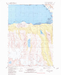
1983 Map of Valdez A-7 SE
USGS Topo · Published 1983About this map
Industrial expansion and maritime operations define this coastal landscape on the northern shores of Port Valdez during the early 1980s. The map illustrates the massive footprint of the Valdez Marine Terminal along the southern shoreline, serving as the terminus for the Trans-Alaska Pipeline. To the east, the Old Valdez (Site) stands as a poignant reminder of the community's relocation after the 1964 earthquake, while the contemporary city of Valdez is shown developing to the north near the Ferry Terminal.
Find a feature on this map
32 named features on this map. Tap any name to fly to it.
Don’t see what you’re looking for? This feature index may not catch every label — zoom into the map to look around manually.
Map Details
Editions of this 1983 Valdez A-7 SE Map
This is the sole edition of this map. No revisions or reprints were ever made.
Other maps of this area

1948 · Cordova
USGS Topo · 1:250,000

1950 · Cordova D-7
USGS Topo · 1:63,360

1951 · Cordova
USGS Topo · 1:250,000

1951 · Cordova D-6
USGS Topo · 1:63,360

1951 · Valdez A-6
USGS Topo · 1:63,360

1952 · Valdez
USGS Topo · 1:250,000

1952 · Cordova D-7
USGS Topo · 1:63,360

1952 · Valdez A-6
USGS Topo · 1:63,360

1953 · Cordova D-6
USGS Topo · 1:63,360

1959 · Cordova
USGS Topo · 1:250,000