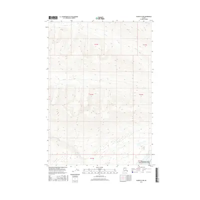
2016 Map of Valdez B-2 NW
USGS Topo · Published 2016About this map
Wrangell-Saint Elias National Park encompasses the southeastern corner of this Alaskan interior landscape, where the mighty Copper River cuts through the terrain. The glacial and snowmelt hydrology is defined by the Ufanatina River, which flows westward across the southern reaches, and smaller mountain drainages including O'Brien Cr and Haley Cr. This 2016 survey illustrates the dramatic verticality of the Copper River Basin, showing a landscape almost entirely devoid of human infrastructure or permanent settlements. Researchers can trace the complex braided channel patterns of the larger rivers as they navigate through narrow valleys and open basins before the river joins the greater Copper River system.
Find a feature on this map
11 named features on this map. Tap any name to fly to it.
Don’t see what you’re looking for? This feature index may not catch every label — zoom into the map to look around manually.
Map Details
Editions of this 2016 Valdez B-2 NW Map
This is the sole edition of this map. No revisions or reprints were ever made.
Other maps of this area

1951 · Valdez B-2
USGS Topo · 1:63,360

1951 · Valdez B-3
USGS Topo · 1:63,360

1951 · Valdez C-2
USGS Topo · 1:63,360

1951 · Valdez C-3
USGS Topo · 1:63,360

1952 · Valdez
USGS Topo · 1:250,000

1953 · Valdez C-2
USGS Topo · 1:63,360

1953 · Valdez C-3
USGS Topo · 1:63,360

1960 · Valdez
USGS Topo · 1:250,000
1995 · Valdez B-3
USGS Topo · 1:63,360

1996 · Valdez C-2
USGS Topo · 1:63,360