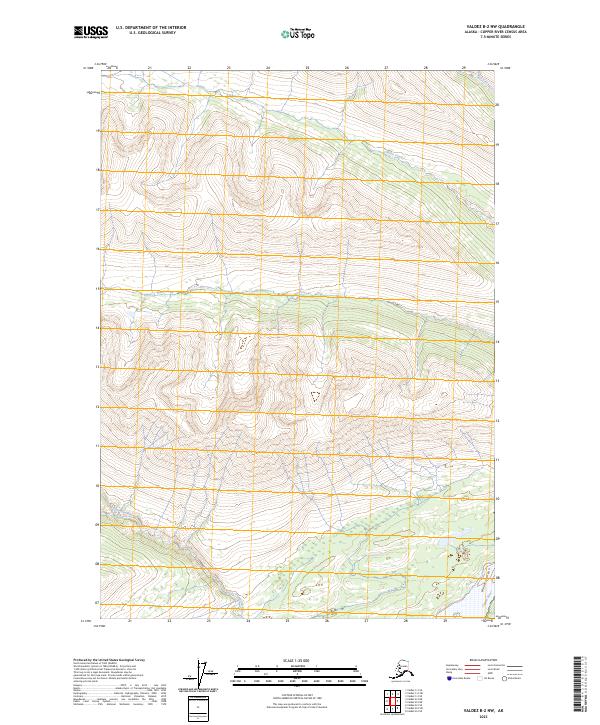
2023 Map of Valdez B-2 NW
USGS Topo · Published 2023About this map
Wrangell-St. Elias Wilderness dominates the southeastern corner of this quadrangle, preserving a vast roadless expanse where the landscape is defined by drainage patterns rather than human infrastructure. The Copper River flows through the south, carving through the steep terrain of Wood Canyon as it moves toward the coast. The absence of roads or permanent settlements in this 2023 survey highlights the region's character as a primitive corridor, where the only landmarks are the intersecting waterways. Tributaries like the Uranatina River and Haley Creek cut across the central and southern sections, while O'Brien Creek and Fox Creek drain the northern slopes. This map detail offers a precise look at the township and range divisions across this remote portion of the Copper River Census Area, illustrating how the wilderness remains largely untouched by development.
Find a feature on this map
13 named features on this map. Tap any name to fly to it.
Don’t see what you’re looking for? This feature index may not catch every label — zoom into the map to look around manually.
Map Details
Editions of this 2023 Valdez B-2 NW Map
This is the sole edition of this map. No revisions or reprints were ever made.
Other maps of this area

1951 · Valdez B-2
USGS Topo · 1:63,360

1951 · Valdez B-3
USGS Topo · 1:63,360

1951 · Valdez C-2
USGS Topo · 1:63,360

1951 · Valdez C-3
USGS Topo · 1:63,360

1952 · Valdez
USGS Topo · 1:250,000

1953 · Valdez C-2
USGS Topo · 1:63,360

1953 · Valdez C-3
USGS Topo · 1:63,360

1960 · Valdez
USGS Topo · 1:250,000
1995 · Valdez B-3
USGS Topo · 1:63,360

1996 · Valdez C-2
USGS Topo · 1:63,360