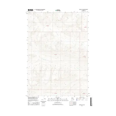
2016 Map of Valdez B-3 NE
USGS Topo · Published 2016About this map
Uranatina River meanders across the southern sections of this interior Alaskan landscape, which is defined by significant elevation changes and glacial-fed drainage systems. Located within the Unorganized Borough, the topography is dominated by steep mountain slopes and deep valleys that channel water into smaller tributaries like Haley Cr and O'Brien Cr. The survey provides an exacting look at the hydrological patterns and high-altitude terrain of the region, including the precise township and range boundaries of t5s r3e and surrounding sections. Unlike more developed areas, this map reveals a landscape governed by geological features rather than human infrastructure, serving as a vital baseline for environmental study and backcountry navigation in the wilderness near Valdez.
Find a feature on this map
9 named features on this map. Tap any name to fly to it.
Don’t see what you’re looking for? This feature index may not catch every label — zoom into the map to look around manually.
Map Details
Editions of this 2016 Valdez B-3 NE Map
This is the sole edition of this map. No revisions or reprints were ever made.
Other maps of this area

1951 · Valdez B-2
USGS Topo · 1:63,360

1951 · Valdez B-3
USGS Topo · 1:63,360

1951 · Valdez C-2
USGS Topo · 1:63,360

1951 · Valdez C-3
USGS Topo · 1:63,360

1952 · Valdez
USGS Topo · 1:250,000

1953 · Valdez C-2
USGS Topo · 1:63,360

1953 · Valdez C-3
USGS Topo · 1:63,360

1960 · Valdez
USGS Topo · 1:250,000
1995 · Valdez B-3
USGS Topo · 1:63,360

1996 · Valdez C-2
USGS Topo · 1:63,360