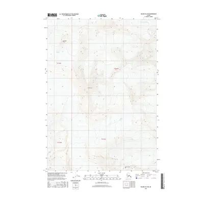
2016 Map of Valdez B-6 SW
USGS Topo · Published 2016About this map
Klutina Glacier and the Valdez Glacier dominate this high-altitude Alaskan landscape, where ice and rock dictate the geography. The survey shows the stark division of the terrain into the Ted Stevens Icefield to the northeast and several prominent summits that break through the glacial coverage. Notable peaks such as Mt Schrader, Townsend Peak, and Abercrombie Mtn provide the primary landmarks in an area defined by massive ice sheets rather than human settlement. The map serves as a record of these glacial boundaries and mountain heights as they existed in the early twenty-first century, offering a clear view of the drainage patterns and topographic relief between the Chugach Mountains and the interior.
Find a feature on this map
10 named features on this map. Tap any name to fly to it.
Don’t see what you’re looking for? This feature index may not catch every label — zoom into the map to look around manually.
Map Details
Editions of this 2016 Valdez B-6 SW Map
This is the sole edition of this map. No revisions or reprints were ever made.
Other maps of this area

1951 · Valdez B-6
USGS Topo · 1:63,360

1951 · Valdez A-6
USGS Topo · 1:63,360

1952 · Valdez
USGS Topo · 1:250,000

1952 · Valdez A-6
USGS Topo · 1:63,360

1953 · Valdez B-6
USGS Topo · 1:63,360

1960 · Valdez B-7
USGS Topo · 1:63,360

1960 · Valdez A-7
USGS Topo · 1:63,360

1960 · Valdez
USGS Topo · 1:250,000
1983 · Valdez A-6 NW
USGS Topo · 1:25,000
1983 · Valdez A-7 NE
USGS Topo · 1:25,000