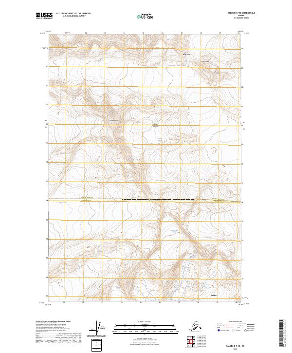
2023 Map of Valdez B-7 SE
USGS Topo · Published 2023About this map
Mount Logan and Valdez Summit anchor this high-elevation Alaskan terrain, where the landscape is defined by massive ice fields and steep glacial valleys. The map documents the northern reaches of Valdez, situated near the boundary of Copper River and Chugach counties. The area is a complex network of moving ice and drainage, featuring the expansive Valdez Glacier and the Shoup Glacier further west.
Find a feature on this map
16 named features on this map. Tap any name to fly to it.
Don’t see what you’re looking for? This feature index may not catch every label — zoom into the map to look around manually.
Map Details
Editions of this 2023 Valdez B-7 SE Map
This is the sole edition of this map. No revisions or reprints were ever made.
Other maps of this area

1951 · Valdez B-6
USGS Topo · 1:63,360

1951 · Valdez A-6
USGS Topo · 1:63,360

1952 · Valdez
USGS Topo · 1:250,000

1952 · Valdez A-6
USGS Topo · 1:63,360

1953 · Valdez B-6
USGS Topo · 1:63,360

1960 · Valdez B-7
USGS Topo · 1:63,360

1960 · Valdez A-7
USGS Topo · 1:63,360

1960 · Valdez
USGS Topo · 1:250,000
1983 · Valdez A-6 NW
USGS Topo · 1:25,000
1983 · Valdez A-7 NE
USGS Topo · 1:25,000