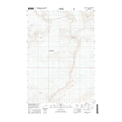
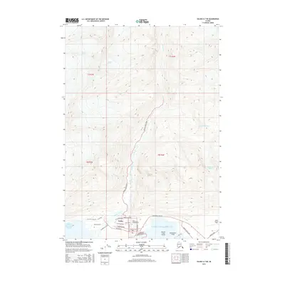
2016 Map of Valdez B-7 SW
USGS Topo · Published 2016About this map
Ice and high-altitude peaks dominate this portion of the Chugach National Forest, where the topography is defined by the massive slow-moving flows of the Tazlina Glacier and the Columbia Glacier. These frozen rivers carve through a landscape anchored by prominent summits such as Mt Cashman and Mt Shoupina. The survey details the convergence of glacial ice and high-relief terrain, providing a record of the eastern extent of the Shoup Glacier and the northern reaches of the Valdez Glacier. As of this 2016 edition, the map illustrates the immense scale of the ice fields and the surrounding peaks like Tazcol Peak and Lindita Peak, reflecting a wilderness devoid of modern roads or settlements, where the primary geographic features are geological and meteorological in nature.
Find a feature on this map
13 named features on this map. Tap any name to fly to it.
Don’t see what you’re looking for? This feature index may not catch every label — zoom into the map to look around manually.
Map Details
Editions of this 2016 Valdez B-7 SW Map
This is the sole edition of this map. No revisions or reprints were ever made.
Other maps of this area

1952 · Valdez
USGS Topo · 1:250,000

1960 · Valdez A-8
USGS Topo · 1:63,360

1960 · Valdez B-7
USGS Topo · 1:63,360

1960 · Valdez B-8
USGS Topo · 1:63,360

1960 · Valdez A-7
USGS Topo · 1:63,360

1960 · Valdez
USGS Topo · 1:250,000
1983 · Valdez A-7 NE
USGS Topo · 1:25,000
1995 · Valdez A-8
USGS Topo · 1:63,360
1996 · Valdez A-7
USGS Topo · 1:63,360
2016 · Valdez A-7 NE
USGS Topo · 1:25,000