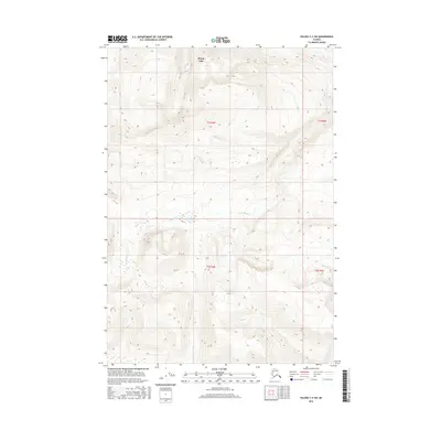
2016 Map of Valdez C-2 SW
USGS Topo · Published 2016About this map
Kenny Lake sits at the northern edge of this high-elevation landscape, where the Copper River basin transitions into the steep slopes of the Chugach Mountains. The drainage patterns on this 2016 survey reveal the flow of glacial and mountain runoff through a network of small streams including Liberty Cr, Fivemile Cr, and Hundell Cr. These watercourses carve through complex terrain marked by significant vertical relief, illustrating the raw geological character of the Unorganized Borough. While modern infrastructure is absent from the central and southern portions of this sheet, the map serves as a precise record of the natural hydrology feeding into larger regional river systems. The southern reaches are defined by the headwaters of Fox Cr, which traverses the high ridges in the T4S R4E and T4S R5E townships.
Find a feature on this map
9 named features on this map. Tap any name to fly to it.
Don’t see what you’re looking for? This feature index may not catch every label — zoom into the map to look around manually.
Map Details
Editions of this 2016 Valdez C-2 SW Map
This is the sole edition of this map. No revisions or reprints were ever made.
Other maps of this area

1951 · Valdez B-2
USGS Topo · 1:63,360

1951 · Valdez B-3
USGS Topo · 1:63,360

1951 · Valdez C-2
USGS Topo · 1:63,360

1951 · Valdez C-3
USGS Topo · 1:63,360

1952 · Valdez
USGS Topo · 1:250,000

1953 · Valdez C-2
USGS Topo · 1:63,360

1953 · Valdez C-3
USGS Topo · 1:63,360

1960 · Valdez
USGS Topo · 1:250,000
1995 · Valdez B-3
USGS Topo · 1:63,360

1996 · Valdez C-2
USGS Topo · 1:63,360