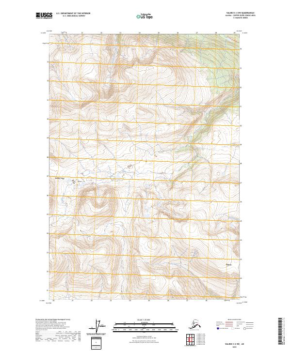
2023 Map of Valdez C-2 SW
USGS Topo · Published 2023About this map
Chitina sits at the base of steep elevation changes where the high interior of the Copper River Census Area descends toward the river valley. This map highlights the complex drainage patterns of the Alaskan wilderness, most notably where Hundell Creek cuts through the high-altitude terrain in the northern sections. The contour lines reveal a landscape of sharp ridges and deep glacial valleys typical of the region's southern interior. The settlement of Chitina serves as a critical point of human presence in an otherwise sparsely populated environment, reflecting the historical role of the area as a gateway to the region's interior resources and transportation routes.
Find a feature on this map
2 named features on this map. Tap any name to fly to it.
Don’t see what you’re looking for? This feature index may not catch every label — zoom into the map to look around manually.
Map Details
Editions of this 2023 Valdez C-2 SW Map
This is the sole edition of this map. No revisions or reprints were ever made.
Other maps of this area

1951 · Valdez B-2
USGS Topo · 1:63,360

1951 · Valdez B-3
USGS Topo · 1:63,360

1951 · Valdez C-2
USGS Topo · 1:63,360

1951 · Valdez C-3
USGS Topo · 1:63,360

1952 · Valdez
USGS Topo · 1:250,000

1953 · Valdez C-2
USGS Topo · 1:63,360

1953 · Valdez C-3
USGS Topo · 1:63,360

1960 · Valdez
USGS Topo · 1:250,000
1995 · Valdez B-3
USGS Topo · 1:63,360

1996 · Valdez C-2
USGS Topo · 1:63,360