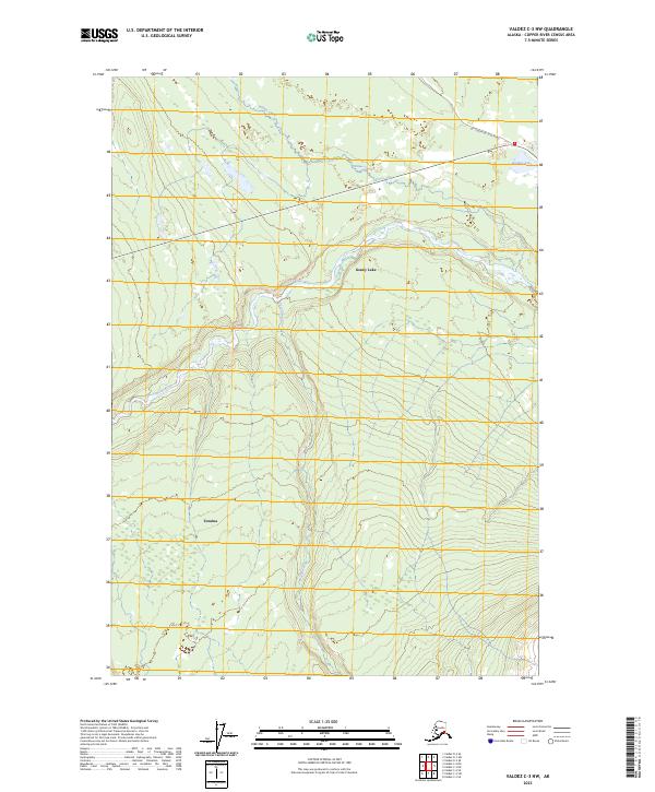
2023 Map of Valdez C-3 NW
USGS Topo · Published 2023About this map
Tonsina and the northern reaches of the Kenny Lake settlement anchor this 2023 survey of the Copper River Census Area. The landscape is defined by the heavy glacial drainage of the Tonsina River, which serpentines across the central terrain. Human activity is concentrated along the corridor of the Old Edgerton Loop Road, tracing the historic path of the Edgerton Highway. Smaller tributaries like Willow Creek and Dust Creek cut through the surrounding hills, illustrating the drainage patterns that have shaped local transport and settlement for generations. The map provides a clear record of the modern township boundaries and the intersection of the river system with established interior roadways.
Find a feature on this map
12 named features on this map. Tap any name to fly to it.
Don’t see what you’re looking for? This feature index may not catch every label — zoom into the map to look around manually.
Map Details
Editions of this 2023 Valdez C-3 NW Map
This is the sole edition of this map. No revisions or reprints were ever made.
Other maps of this area

1949 · Valdez D-4
USGS Topo · 1:63,360

1951 · Valdez C-3
USGS Topo · 1:63,360

1951 · Valdez C-4
USGS Topo · 1:63,360

1952 · Valdez
USGS Topo · 1:250,000

1952 · Valdez D-4
USGS Topo · 1:63,360

1953 · Valdez C-3
USGS Topo · 1:63,360

1953 · Valdez C-4
USGS Topo · 1:63,360

1958 · Valdez D-3
USGS Topo · 1:63,360

1960 · Valdez
USGS Topo · 1:250,000
1996 · Valdez C-4
USGS Topo · 1:63,360