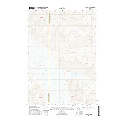
2016 Map of Valdez C-8 NW
USGS Topo · Published 2016About this map
Nelchina Glacier dominates the southern landscape of this 2016 survey, where the ice and its runoff define the local geography at the border of the Matanuska-Susitna Borough and the Valdez-Cordova Census Area. To the north, the flow of Brunette Cr cuts through the high terrain, illustrating the intricate drainage patterns of the region. The map reflects a modern topographical study, documenting elevation and water systems before potential environmental shifts. This specific quadrant is characterized by its isolation and the clear administrative line dividing two of Alaska's major regions, providing researchers with a precise record of the glacial extent and hydrological features like Brunette Cr as they appeared in the early 21st century.
Find a feature on this map
10 named features on this map. Tap any name to fly to it.
Don’t see what you’re looking for? This feature index may not catch every label — zoom into the map to look around manually.
Map Details
Editions of this 2016 Valdez C-8 NW Map
This is the sole edition of this map. No revisions or reprints were ever made.
Other maps of this area

1948 · Anchorage D-1
USGS Topo · 1:63,360

1949 · Valdez D-8
USGS Topo · 1:63,360

1951 · Anchorage
USGS Topo · 1:250,000

1951 · Anchorage D-1
USGS Topo · 1:63,360

1952 · Valdez D-8
USGS Topo · 1:63,360

1952 · Valdez
USGS Topo · 1:250,000

1960 · Valdez C-8
USGS Topo · 1:63,360

1960 · Anchorage C-1
USGS Topo · 1:63,360

1960 · Valdez
USGS Topo · 1:250,000

1962 · Anchorage
USGS Topo · 1:250,000