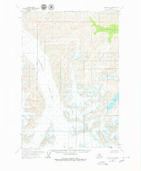
1960 Map of Valdez C-8
USGS Topo · Published 1980About this map
Nelchina Glacier dominates the western half of this interior landscape, a massive ice field defined by extensive crevasses and rugged contours. The topography captures the transition from glacial ice to high mountain peaks, including the summit of Fisher. On the eastern side, the drainage system of Klanelneechena Creek flows through deep valleys, joined by Barnette Creek in the north. The presence of the Matanuska-Susitna Borough Boundary East running vertically through the glacier indicates the administrative divisions within this uninhabited region. Mapped with data collected throughout the 1950s, the sheet reveals a primitive environment where landforms are the only landmarks, providing an essential record of the glacial extent before modern climatic shifts.
Find a feature on this map
6 named features on this map. Tap any name to fly to it.
Don’t see what you’re looking for? This feature index may not catch every label — zoom into the map to look around manually.
Map Details
Editions of this 1960 Valdez C-8 Map
3 editions found

Other maps of this area

1948 · Anchorage D-1
USGS Topo · 1:63,360

1949 · Valdez D-8
USGS Topo · 1:63,360

1949 · Valdez D-7
USGS Topo · 1:63,360

1951 · Valdez D-7
USGS Topo · 1:63,360

1951 · Anchorage
USGS Topo · 1:250,000

1951 · Anchorage D-1
USGS Topo · 1:63,360

1952 · Valdez D-8
USGS Topo · 1:63,360

1952 · Valdez
USGS Topo · 1:250,000

1960 · Valdez B-7
USGS Topo · 1:63,360

1960 · Valdez C-7
USGS Topo · 1:63,360