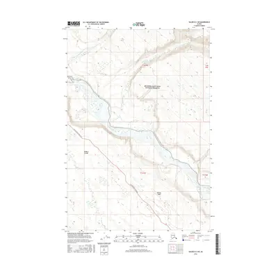
2016 Map of Valdez D-3 SW
USGS Topo · Published 2016About this map
The confluence of the Copper River and the Dadina River anchors this Alaskan landscape within the Wrangell-Saint Elias National Preserve. The map documents the rural development around Willow Creek and Kenny Lake, where the Old Edgerton Loop Road serves as the primary artery for local travel and transport. These settlements represent the human footprint in a region dominated by glacial drainages and dramatic elevation changes, with the Nadina River and Willow Cr cutting through the northern and southern sectors respectively. The topographic survey illustrates the braided nature of the Copper River as it passes through the glacial valleys, providing a clear record of the watershed and transportation corridor in the early 21st century.
Find a feature on this map
13 named features on this map. Tap any name to fly to it.
Don’t see what you’re looking for? This feature index may not catch every label — zoom into the map to look around manually.
Map Details
Editions of this 2016 Valdez D-3 SW Map
This is the sole edition of this map. No revisions or reprints were ever made.
Other maps of this area

1949 · Valdez D-4
USGS Topo · 1:63,360

1951 · Valdez C-3
USGS Topo · 1:63,360

1951 · Valdez C-4
USGS Topo · 1:63,360

1952 · Valdez
USGS Topo · 1:250,000

1952 · Valdez D-4
USGS Topo · 1:63,360

1953 · Valdez C-3
USGS Topo · 1:63,360

1953 · Valdez C-4
USGS Topo · 1:63,360

1958 · Valdez D-3
USGS Topo · 1:63,360

1960 · Valdez
USGS Topo · 1:250,000
1996 · Valdez C-4
USGS Topo · 1:63,360