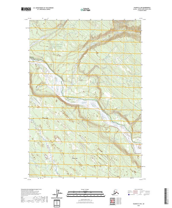
2023 Map of Valdez D-3 SW
USGS Topo · Published 2023About this map
The Copper River braids through the center of this landscape, its wide gravel bars and shifting channels creating a complex hydraulic system typical of the Copper River Basin. Along its western banks, the communities of Willow Creek and Kenny Lake represent the localized settlement patterns of the region, connected by the Old Edgerton Loop Road. These areas are situated just west of the sprawling Wrangell-Saint Elias National Preserve, which dominates the northern and eastern portions of the sheet. To the north, the Nadina River and Dadina River flow toward the main trunk of the Copper River, cutting through terrain characterized by low-lying wetlands and seasonal drainage. This map captures the intersection of federal protected lands and the resilient local homesteads that define this part of the Alaska interior.
Find a feature on this map
13 named features on this map. Tap any name to fly to it.
Don’t see what you’re looking for? This feature index may not catch every label — zoom into the map to look around manually.
Map Details
Editions of this 2023 Valdez D-3 SW Map
This is the sole edition of this map. No revisions or reprints were ever made.
Other maps of this area

1949 · Valdez D-4
USGS Topo · 1:63,360

1951 · Valdez C-3
USGS Topo · 1:63,360

1951 · Valdez C-4
USGS Topo · 1:63,360

1952 · Valdez
USGS Topo · 1:250,000

1952 · Valdez D-4
USGS Topo · 1:63,360

1953 · Valdez C-3
USGS Topo · 1:63,360

1953 · Valdez C-4
USGS Topo · 1:63,360

1958 · Valdez D-3
USGS Topo · 1:63,360

1960 · Valdez
USGS Topo · 1:250,000
1996 · Valdez C-4
USGS Topo · 1:63,360