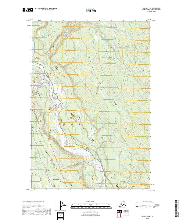
2023 Map of Valdez D-4 NE
USGS Topo · Published 2023About this map
The Copper River dominates the landscape of this region, carved into the terrain at the western edge of the Wrangell-Saint Elias National Preserve. The settlement of Copper Center serves as a primary hub for this stretch of the Copper River Valley, situated at the confluence of the Klutina River and the larger main stem. This survey documents the intersection of critical Alaskan infrastructure and natural wilderness, where the Alaska Pipeline and the Richardson Highway run roughly parallel to the river's course. To the south, the settlement of Willow Creek and the Copper Center Airport provide vital connections to this interior corridor. The map captures the braided nature of the river system, including the contributions of Yetna Creek and the Klawasi River, revealing a landscape shaped by glacial waters and modern transit networks.
Find a feature on this map
15 named features on this map. Tap any name to fly to it.
Don’t see what you’re looking for? This feature index may not catch every label — zoom into the map to look around manually.
Map Details
Editions of this 2023 Valdez D-4 NE Map
This is the sole edition of this map. No revisions or reprints were ever made.
Other maps of this area

1949 · Gulkana A-3
USGS Topo · 1:63,360

1949 · Valdez D-4
USGS Topo · 1:63,360

1951 · Gulkana
USGS Topo · 1:250,000

1952 · Gulkana A-3
USGS Topo · 1:63,360

1952 · Valdez
USGS Topo · 1:250,000

1952 · Valdez D-4
USGS Topo · 1:63,360

1958 · Valdez D-3
USGS Topo · 1:63,360

1959 · Gulkana
USGS Topo · 1:250,000

1960 · Valdez
USGS Topo · 1:250,000

1965 · Gulkana
USGS Topo · 1:250,000