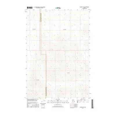
2016 Map of Valdez D-8 SW
USGS Topo · Published 2016About this map
Nelchina Bench Lake sits at the northern edge of this high-elevation Alaskan terrain, where the landscape is defined by its drainage systems and administrative boundaries. The map document traces the divide between the Matanuska-Susitna Borough and the Valdez-Cordova Census Area, a line that cuts vertically through the complex topography of the Nelchina area. Steep-sided valleys are carved by the southern-flowing Barnette Cr and the eastward-draining Bottley Cr, illustrating the rugged catchment areas that characterize the Copper River Basin's periphery. This 2016 survey provides a precise look at the glacial and fluvial landforms before any significant modern infrastructure development, preserving the primitive hydrology of these high-country streams.
Find a feature on this map
8 named features on this map. Tap any name to fly to it.
Don’t see what you’re looking for? This feature index may not catch every label — zoom into the map to look around manually.
Map Details
Editions of this 2016 Valdez D-8 SW Map
This is the sole edition of this map. No revisions or reprints were ever made.
Other maps of this area

1948 · Anchorage D-1
USGS Topo · 1:63,360

1949 · Valdez D-8
USGS Topo · 1:63,360

1951 · Anchorage
USGS Topo · 1:250,000

1951 · Anchorage D-1
USGS Topo · 1:63,360

1952 · Valdez D-8
USGS Topo · 1:63,360

1952 · Valdez
USGS Topo · 1:250,000

1960 · Valdez C-8
USGS Topo · 1:63,360

1960 · Anchorage C-1
USGS Topo · 1:63,360

1960 · Valdez
USGS Topo · 1:250,000

1962 · Anchorage
USGS Topo · 1:250,000