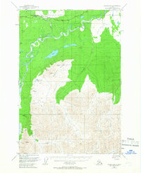
1949 Map of Valdez D-8
USGS Topo · Published 1966About this map
The Little Nelchina River winds through this Alaskan interior landscape, just as it was being surveyed and field-annotated in the late 1940s. The Glenn Highway provides the primary corridor through the north, passing a Gravel Pit and several Cabins that served as early footholds for travelers and workers in the region. The map reveals a transition from the river valley's wet lowlands to the striking elevations of Heavenly Ridge.
Find a feature on this map
11 named features on this map. Tap any name to fly to it.
Don’t see what you’re looking for? This feature index may not catch every label — zoom into the map to look around manually.
Map Details
Editions of this 1949 Valdez D-8 Map
3 editions found
Other maps of this area

1948 · Anchorage D-1
USGS Topo · 1:63,360

1949 · Talkeetna Mountains A-1
USGS Topo · 1:63,360

1949 · Gulkana A-6
USGS Topo · 1:63,360

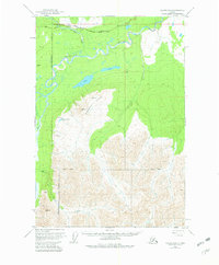
1949 · Valdez D-8
USGS Topo · 1:63,360

1949 · Valdez D-7
USGS Topo · 1:63,360

1950 · Talkeetna Mountains
USGS Topo · 1:250,000

1951 · Gulkana
USGS Topo · 1:250,000

1951 · Valdez D-7
USGS Topo · 1:63,360

1951 · Anchorage
USGS Topo · 1:250,000

1951 · Anchorage D-1
USGS Topo · 1:63,360