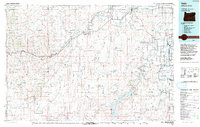
1993 Map of Vale
USGS Topo · Published 1993About this map
The Malheur River and Owyhee River converge toward the Snake River in this detailed topographic study of eastern Oregon and the Idaho border. The landscape is defined by extensive irrigation networks and prominent geological formations, such as Hoodoo Ridge and Grassy Mountain. The agricultural and transportation hub around Vale and Nyssa is well-documented, showing the path of the Union Pacific railroad and local infrastructure like Miller Memorial Airpark.
Find a feature on this map
95 named features on this map. Tap any name to fly to it.
Don’t see what you’re looking for? This feature index may not catch every label — zoom into the map to look around manually.
Map Details
Editions of this 1993 Vale Map
2 editions found
Other maps of this area

1892 · Silver City
USGS Topo · 1:125,000

1894 · Silver City
USGS Topo · 1:125,000

1897 · Weiser
USGS Topo · 1:125,000

1898 · Nampa
USGS Topo · 1:125,000

1898 · Silver City
USGS Topo · 1:125,000

1906 · Mitchell Butte
USGS Topo · 1:125,000

1908 · Ironside Mountain
USGS Topo · 1:125,000

1950 · Jamieson
USGS Topo · 1:62,500

1951 · Malheur Butte
USGS Topo · 1:24,000

1951 · Moores Hollow
USGS Topo · 1:62,500