
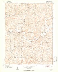
1950 Map of Valeene
USGS Topo · Published 1952About this map
The Patoka River winds through the heart of southern Orange County, carving a path through the dense terrain of the Hoosier National Forest. In the mid-century, this landscape was defined by small, dispersed communities and the infrastructure of rural life, anchored by settlements like Valeene and Youngs Creek. The map reveals a high concentration of local institutions, including Concord Ch, Cooks Ch, and numerous country schoolhouses such as School No 7 and the Pearsonstown Sch.
Find a feature on this map
40 named features on this map. Tap any name to fly to it.
Don’t see what you’re looking for? This feature index may not catch every label — zoom into the map to look around manually.
Map Details
Editions of this 1950 Valeene Map
3 editions found
Other maps of this area

1947 · Hardinsburg
USGS Topo · 1:24,000

1948 · Milltown
USGS Topo · 1:24,000

1949 · Hardinsburg
USGS Topo · 1:24,000

1950 · English
USGS Topo · 1:24,000

1951 · French Lick
USGS Topo · 1:24,000

1956 · Greenbrier
USGS Topo · 1:24,000

1956 · Taswell
USGS Topo · 1:24,000

1956 · Vincennes
USGS Topo · 1:250,000

1957 · Vincennes
USGS Topo · 1:250,000

1957 · Livonia
USGS Topo · 1:24,000