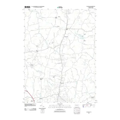
2010 Map of Valencia
USGS Topo · Published 2010About this map
Glade Run and its numerous tributaries, including Willow Run and the West Branch Deer Creek, define the landscape of southern Butler County in this 2010 survey. The area maintains a mix of established small settlements and rural infrastructure, anchored by the community of Valencia and its central Valencia Post Office. To the north and east, the transition from agricultural land to residential development is evident around Cooperstown and Glade Mills, while landmarks such as Hays Mill and Bakerstown Station reflect the historical milling and transit roots of the region.
Find a feature on this map
89 named features on this map. Tap any name to fly to it.
Don’t see what you’re looking for? This feature index may not catch every label — zoom into the map to look around manually.
Map Details
Editions of this 2010 Valencia Map
This is the sole edition of this map. No revisions or reprints were ever made.
Other maps of this area

1906 · Sewickley
USGS Topo · 1:62,500

1908 · Sewickley
USGS Topo · 1:62,500

1908 · New Kensington
USGS Topo · 1:62,500

1908 · Zelienople
USGS Topo · 1:62,500

1909 · Butler
USGS Topo · 1:62,500

1910 · New Kensington
USGS Topo · 1:62,500

1910 · Zelienople
USGS Topo · 1:62,500

1911 · Butler
USGS Topo · 1:62,500

1950 · Valencia
USGS Topo · 1:24,000

1951 · Canton
USGS Topo · 1:250,000
Featured Places
- Clinton Township, PA
- Bairdford, West Deer Township
- Valencia, PA
- Penn Township, PA
- Middlesex Township, PA