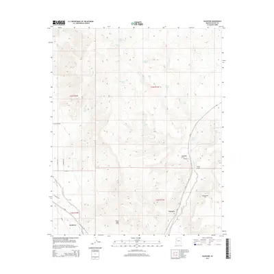
2014 Map of Valentine
USGS Topo · Published 2014About this map
Valentine and Hackberry sit along the historic corridor of Az-66, serving as notable reference points in this high desert landscape of northwestern Arizona. The terrain is dramatically defined by the Grand Wash Cliffs to the south and the Cottonwood Cliffs to the east, which create a natural boundary for the winding path of Truxton Wash. Water sources are critical features of this arid environment, represented by a network of springs and man-made tanks including Upper Grapevine Spring, Walnut Spring, and Slats Tank. The settlement of Crozier is tucked near the base of the cliffs, where Wright Canyon and Crozier Canyon Spring reveal the complex drainage patterns feeding into the wash. This modern survey demonstrates how residential streets like E Mesquite Ave and E El Norte St have been established in proximity to these ancient geologic formations.
Find a feature on this map
30 named features on this map. Tap any name to fly to it.
Don’t see what you’re looking for? This feature index may not catch every label — zoom into the map to look around manually.
Map Details
Editions of this 2014 Valentine Map
This is the sole edition of this map. No revisions or reprints were ever made.
Other maps of this area

1886 · Diamond Creek
USGS Topo · 1:250,000

1892 · Diamond Creek
USGS Topo · 1:250,000

1948 · Williams
USGS Topo · 1:250,000

1954 · Williams
USGS Topo · 1:250,000

1956 · Williams
USGS Topo · 1:250,000

1960 · Williams
USGS Topo · 1:250,000

1961 · Williams
USGS Topo · 1:250,000
1967 · Milkweed Canyon SE
USGS Topo · 1:24,000

1967 · Milkweed Canyon SW
USGS Topo · 1:24,000
1968 · Peacock Peak
USGS Topo · 1:24,000