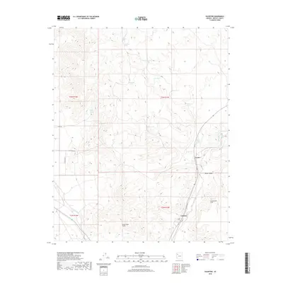
2018 Map of Valentine
USGS Topo · Published 2018About this map
The Grand Wash Cliffs and Cottonwood Cliffs dominate this portion of the Arizona high desert, where water sources have long dictated the patterns of settlement. The small community of Valentine is situated along Valentine Way, while the settlement of Crozier lies to the north near the winding path of Truxton Wash. This terrain is defined by a series of critical watering points, including Crozier Spring, Walnut Spring, and the appropriately named Stone Corral Spring, which supported ranching and transit through the region. In the eastern part of the quadrangle, Wright Canyon cuts through the elevation, illustrating the dramatic geography that historically funneled travel along the rail and road corridors connecting these desert outposts.
Find a feature on this map
25 named features on this map. Tap any name to fly to it.
Don’t see what you’re looking for? This feature index may not catch every label — zoom into the map to look around manually.
Map Details
Editions of this 2018 Valentine Map
This is the sole edition of this map. No revisions or reprints were ever made.
Other maps of this area

1886 · Diamond Creek
USGS Topo · 1:250,000

1892 · Diamond Creek
USGS Topo · 1:250,000

1948 · Williams
USGS Topo · 1:250,000

1954 · Williams
USGS Topo · 1:250,000

1956 · Williams
USGS Topo · 1:250,000

1960 · Williams
USGS Topo · 1:250,000

1961 · Williams
USGS Topo · 1:250,000
1967 · Milkweed Canyon SE
USGS Topo · 1:24,000

1967 · Milkweed Canyon SW
USGS Topo · 1:24,000
1968 · Peacock Peak
USGS Topo · 1:24,000