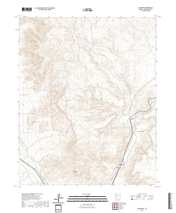
2021 Map of Valentine
USGS Topo · Published 2021About this map
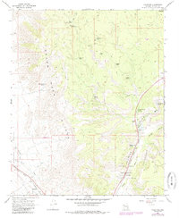
Valentine and Crozier sit within a landscape defined by the dramatic transitions of the Cottonwood Cliffs and Grand Wash Cliffs. This 2021 survey documents the persistent water sources essential to this arid region of Mohave County, marking numerous springs and man-made tanks. Strategic water points like Grapevine Spring, Stone Corral Spring, and Easter Tank illustrate the historical and ongoing importance of ranching and transit infrastructure. The map follows the path of Truxton Wash as it cuts through the terrain, paralleling the corridor where Valentine Way serves as a primary local artery. These named features, including the rise of Serendipity Mtn and the depths of Wright Canyon, provide a clear view of the natural landmarks that have guided travelers through this territory for generations.
Find a feature on this map
25 named features on this map. Tap any name to fly to it.
Don’t see what you’re looking for? This feature index may not catch every label — zoom into the map to look around manually.
Map Details
Editions of this 2021 Valentine Map
This is the sole edition of this map. No revisions or reprints were ever made.
Historical Maps of Valentine Through Time
3 maps found