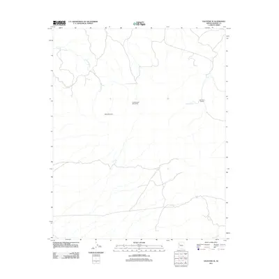
2011 Map of Valentine SE
USGS Topo · Published 2011About this map
The Cottonwood Mountains dominate this high-desert landscape in Mohave County, where a network of seasonal watercourses and remote springs defines the local geography. Significant landmarks such as Slate Mountain and the deep cuts of Red Horn Canyon characterize the transition between plateaus and drainage basins. Water sources, vital for regional survival and ranching history, are represented by Little Cottonwood Spring and Red Horn Spring, which feed into the larger drainages of Cottonwood Creek and Willow Creek. This 2011 survey illustrates the modern road network navigating the varied elevations of the Arizona interior, providing a clear record of the physical corridor through these western ranges.
Find a feature on this map
7 named features on this map. Tap any name to fly to it.
Don’t see what you’re looking for? This feature index may not catch every label — zoom into the map to look around manually.
Map Details
Editions of this 2011 Valentine SE Map
This is the sole edition of this map. No revisions or reprints were ever made.
Other maps of this area

1886 · Diamond Creek
USGS Topo · 1:250,000

1892 · Diamond Creek
USGS Topo · 1:250,000

1948 · Williams
USGS Topo · 1:250,000

1954 · Williams
USGS Topo · 1:250,000

1956 · Williams
USGS Topo · 1:250,000

1960 · Williams
USGS Topo · 1:250,000

1961 · Williams
USGS Topo · 1:250,000
1968 · Truxton
USGS Topo · 1:24,000
1968 · Hackberry
USGS Topo · 1:24,000
1968 · Tin Mountain
USGS Topo · 1:24,000