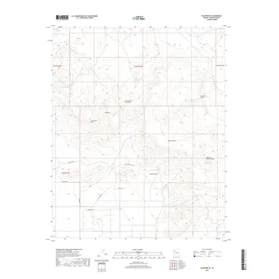
2018 Map of Valentine SE
USGS Topo · Published 2018About this map
The Cottonwood Mountains dominate the landscape in this portion of Mohave County, where high-elevation terrain transitions between the Cottonwood Cliffs and the rugged drainage of Wright Canyon. Water sources are critical markers in this arid environment, represented by Little Cottonwood Spring and Red Horn Spring, which likely served as vital stops for early travelers and cattlemen. The network of local roads, such as Dicks Camp Rd and Tobosa Rd, reflects the area's history of ranching and land management. Researchers can trace the elevation changes from the summit of Slate Mtn down through the East Fork Wright Canyon. The map provides a precise view of the Public Land Survey System, showing the township and range lines that structured settlement and grazing rights in this part of Arizona.
Find a feature on this map
22 named features on this map. Tap any name to fly to it.
Don’t see what you’re looking for? This feature index may not catch every label — zoom into the map to look around manually.
Map Details
Editions of this 2018 Valentine SE Map
This is the sole edition of this map. No revisions or reprints were ever made.
Other maps of this area

1886 · Diamond Creek
USGS Topo · 1:250,000

1892 · Diamond Creek
USGS Topo · 1:250,000

1948 · Williams
USGS Topo · 1:250,000

1954 · Williams
USGS Topo · 1:250,000

1956 · Williams
USGS Topo · 1:250,000

1960 · Williams
USGS Topo · 1:250,000

1961 · Williams
USGS Topo · 1:250,000
1968 · Truxton
USGS Topo · 1:24,000
1968 · Hackberry
USGS Topo · 1:24,000
1968 · Tin Mountain
USGS Topo · 1:24,000