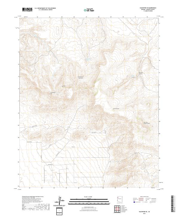
2021 Map of Valentine SE
USGS Topo · Published 2021About this map
Cottonwood Mountains dominate the central portion of this 2021 survey, where the dramatic elevation change is defined by the Cottonwood Cliffs and the prominent peak of Slate Mtn. The landscape is a complex network of arid drainage systems, including Cottonwood Cr and the winding Wright Canyon. These natural features dictate the sparse road network, which primarily consists of rural routes like Dicks Camp Rd and Indian Rice Rd that navigate the high-desert basins. This map provides a contemporary view of the remote Mohave County interior, showing how modern land management and public land survey boundaries like t23n r12w overlay the ancient geological formations. Water sources remain critical landmarks in this environment, evidenced by named locations such as Little Cottonwood Spring and Red Horn Spring.
Find a feature on this map
20 named features on this map. Tap any name to fly to it.
Don’t see what you’re looking for? This feature index may not catch every label — zoom into the map to look around manually.
Map Details
Editions of this 2021 Valentine SE Map
This is the sole edition of this map. No revisions or reprints were ever made.
Other maps of this area

1886 · Diamond Creek
USGS Topo · 1:250,000

1892 · Diamond Creek
USGS Topo · 1:250,000

1948 · Williams
USGS Topo · 1:250,000

1954 · Williams
USGS Topo · 1:250,000

1956 · Williams
USGS Topo · 1:250,000

1960 · Williams
USGS Topo · 1:250,000

1961 · Williams
USGS Topo · 1:250,000
1968 · Truxton
USGS Topo · 1:24,000
1968 · Hackberry
USGS Topo · 1:24,000
1968 · Tin Mountain
USGS Topo · 1:24,000