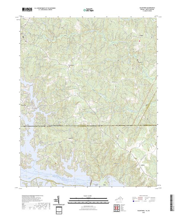
2022 Map of Valentines
USGS Topo · Published 2022About this map
Lake Gaston and Roanoke Rapids Lake dominate the southern portion of this region, where the state line divides Brunswick County, Virginia, from Northampton County, North Carolina. This landscape is defined by the intricate finger-like coves of the reservoir system, which reshaped the geography around Henrico and Gasburg. Further north, the terrain transitions into a network of creek drainages such as Rattlesnake Cr and White Oak Cr that feed the Meherrin River watershed. Small settlements like Valentines and Triplet serve as local anchors connected by historic corridors like Western Mill Rd and Benton Rd. Genealogists may find value in the location of Clary Cem in the northwest, while topographic landmarks like Wilkins Hill and river features such as Clements Island illustrate the original relief before and after the creation of the regional hydroelectric lakes.
Find a feature on this map
103 named features on this map. Tap any name to fly to it.
Don’t see what you’re looking for? This feature index may not catch every label — zoom into the map to look around manually.
Map Details
Editions of this 2022 Valentines Map
This is the sole edition of this map. No revisions or reprints were ever made.
Other maps of this area

1919 · White Plains
USGS Topo · 1:48,000

1919 · Emporia
USGS Topo · 1:62,500

1920 · White Plains
USGS Topo · 1:62,500

1942 · Emporia
USGS Topo · 1:62,500

1953 · Norfolk
USGS Topo · 1:250,000

1963 · Powellton
USGS Topo · 1:24,000

1963 · Barley
USGS Topo · 1:24,000

1963 · Gasburg
USGS Topo · 1:24,000

1963 · Ante
USGS Topo · 1:24,000

1963 · Valentines
USGS Topo · 1:24,000