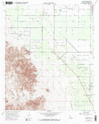
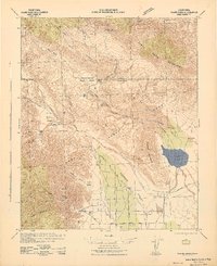
1956 Map of Valerie
USGS Topo · Published 1973About this map
The Torres Martinez Indian Reservation dominates this section of the Coachella Valley, where the desert floor meets the steep ascent of the Santa Rosa Mts. This landscape reveals a long history of human presence, from Early Indian Fish Traps and Petroglyphs near Toro Canyon to more modern settlements like Valerie and 100 Palms. The map documents a complex irrigation and drainage network essential for desert life, including a prominent Levee and the Coachella Valley Stormwater Channel. Local history and genealogy researchers will find several designated burial sites, including Toro Cem and the Martinez Cemetery. The northern boundary is defined by aviation and infrastructure, notably the Thermal Airport and numerous pipelines and pumping stations that supported the region's mid-century development.
Find a feature on this map
49 named features on this map. Tap any name to fly to it.
Don’t see what you’re looking for? This feature index may not catch every label — zoom into the map to look around manually.
Map Details
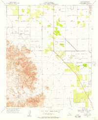
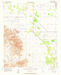
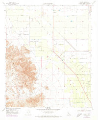
Editions of this 1956 Valerie Map
4 editions found
Other maps of this area

1904 · Indio
USGS Topo · 1:125,000

1931 · Vallecito
USGS Topo · 1:125,000

1941 · Toro Peak
USGS Topo · 1:62,500

1941 · Clark Lake
USGS Topo · 1:62,500

1941 · Coachella
USGS Topo · 1:62,500

1942 · Agua Dulce
USGS Topo · 1:62,500
1942 · Clark Lake
USGS Topo · 1:62,500

1943 · Vallecito
USGS Topo · 1:125,000
1943 · Coachella
USGS Topo · 1:62,500

1944 · Agua Dulce
USGS Topo · 1:62,500