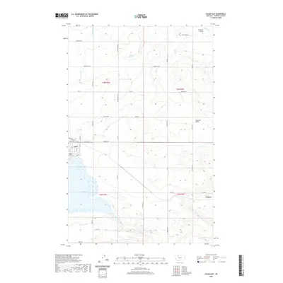
2020 Map of Valier East
USGS Topo · Published 2020About this map
Valier serves as the primary hub of this high plains landscape, situated on the northeastern shores of Lake Frances. This water-centric layout is defined by an extensive network of irrigation infrastructure, including the An Six Canal, An Two Canal, and C Canal, which facilitate agriculture across the prairie. The topography is marked by distinctive drainage features such as Winginaw Coulee and Winginaw Valley to the east, while the Dry Fork Marias River flows across the southern portion of the quadrangle. In the southeast, the small settlement of Williams sits at the intersection of Williams Rd and the local road network. The presence of Valier Airport and named features like Mattick Spring reflect the practical necessities of travel and water management in this Pondera County region.
Find a feature on this map
31 named features on this map. Tap any name to fly to it.
Don’t see what you’re looking for? This feature index may not catch every label — zoom into the map to look around manually.
Map Details
Editions of this 2020 Valier East Map
This is the sole edition of this map. No revisions or reprints were ever made.
Other maps of this area

1920 · Dupuyer
USGS Topo · 1:125,000

1934 · Lake Frances
USGS Topo · 1:48,000

1934 · Valier
USGS Topo · 1:62,500

1936 · Pendroy
USGS Topo · 1:48,000

1937 · Valier
USGS Topo · 1:62,500

1937 · Lake Frances
USGS Topo · 1:62,500

1938 · Gallup City
USGS Topo · 1:62,500

1941 · Pendroy
USGS Topo · 1:62,500

1942 · Gallup City
USGS Topo · 1:62,500

1960 · Cut Bank
USGS Topo · 1:250,000