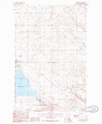
1985 Map of Valier East
USGS Topo · Published 1986About this map
Valier sits at the heart of this high plains landscape, anchored by the expansive waters of Lake Frances. The town's layout reflects a mid-century period of local utility and transport, featuring the Valier Municipal Airport and a prominent Sub Station at its edge. A complex network of irrigation, including the A N 2 Canal and various unnamed canals, cuts across the terrain, illustrating the vital role of water management in this Pondera County agricultural corridor.
Find a feature on this map
18 named features on this map. Tap any name to fly to it.
Don’t see what you’re looking for? This feature index may not catch every label — zoom into the map to look around manually.
Map Details
Editions of this 1985 Valier East Map
This is the sole edition of this map. No revisions or reprints were ever made.
Other maps of this area

1920 · Dupuyer
USGS Topo · 1:125,000

1934 · Lake Frances
USGS Topo · 1:48,000

1934 · Valier
USGS Topo · 1:62,500

1936 · Pendroy
USGS Topo · 1:48,000

1937 · Valier
USGS Topo · 1:62,500

1937 · Lake Frances
USGS Topo · 1:62,500

1938 · Gallup City
USGS Topo · 1:62,500

1941 · Pendroy
USGS Topo · 1:62,500

1942 · Gallup City
USGS Topo · 1:62,500

1960 · Cut Bank
USGS Topo · 1:250,000