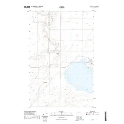
2020 Map of Valier West
USGS Topo · Published 2020About this map
Lake Frances dominates the southeastern quadrant of this Pondera County landscape, serving as a focal point for the town of Valier. The community is organized along a grid of residential streets such as Teton Ave and Illinois Ave, with the Valier Airport and Lakeview Cem situated nearby. A sophisticated network of irrigation infrastructure, including the A Canal, C 3 Canal, and AN Two Canal, defines the local agricultural economy and movement of water across the plains.
Find a feature on this map
40 named features on this map. Tap any name to fly to it.
Don’t see what you’re looking for? This feature index may not catch every label — zoom into the map to look around manually.
Map Details
Editions of this 2020 Valier West Map
This is the sole edition of this map. No revisions or reprints were ever made.
Other maps of this area

1920 · Dupuyer
USGS Topo · 1:125,000

1934 · Lake Frances
USGS Topo · 1:48,000

1934 · Valier
USGS Topo · 1:62,500

1936 · Pendroy
USGS Topo · 1:48,000

1937 · Valier
USGS Topo · 1:62,500

1937 · Lake Frances
USGS Topo · 1:62,500

1938 · Gallup City
USGS Topo · 1:62,500

1941 · Pendroy
USGS Topo · 1:62,500

1942 · Gallup City
USGS Topo · 1:62,500

1960 · Cut Bank
USGS Topo · 1:250,000