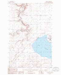
1985 Map of Valier West
USGS Topo · Published 1986About this map
Lake Frances and its extensive irrigation infrastructure dominate this Pondera County landscape in the mid-1980s. The western edge of Valier sits along the shoreline, supported by a levee and featuring the Valier Municipal Airport and a lakeside Boat Ramp. The map captures a complex water management system essential for high-plains agriculture, including the A N 2 Canal, A N Canal, and Laughlin Ditch.
Find a feature on this map
19 named features on this map. Tap any name to fly to it.
Don’t see what you’re looking for? This feature index may not catch every label — zoom into the map to look around manually.
Map Details
Editions of this 1985 Valier West Map
This is the sole edition of this map. No revisions or reprints were ever made.
Other maps of this area

1920 · Dupuyer
USGS Topo · 1:125,000

1934 · Lake Frances
USGS Topo · 1:48,000

1934 · Valier
USGS Topo · 1:62,500

1936 · Pendroy
USGS Topo · 1:48,000

1937 · Valier
USGS Topo · 1:62,500

1937 · Lake Frances
USGS Topo · 1:62,500

1938 · Gallup City
USGS Topo · 1:62,500

1941 · Pendroy
USGS Topo · 1:62,500

1942 · Gallup City
USGS Topo · 1:62,500

1960 · Cut Bank
USGS Topo · 1:250,000