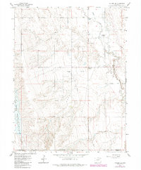
1965 Map of Vallery SE
USGS Topo · Published 1984About this map
Ninemile and twelvemile markers define the sparse prairie landscape of eastern Colorado on the Morgan and Adams County line. This mid-1960s survey reveals a landscape organized by straight-line section roads like Ninemile Road and Sherman Street, cutting across the natural drainage of Badger Creek and Sand Creek. The presence of Adena Station and infrastructure such as a Gasoline Plant, Storage Bins, and multiple pipelines highlights the area's mid-century role in energy and agricultural transport. To the west, the terrain shifts into the broken draws of Adena, where the Rosener Reservoir and a prominent Arroyo provide essential water management in an otherwise arid region. These features, captured during the 1965 field check and updated with 1980s aerial data, document the persistence of high-plains ranching and resource extraction.
Find a feature on this map
18 named features on this map. Tap any name to fly to it.
Don’t see what you’re looking for? This feature index may not catch every label — zoom into the map to look around manually.
Map Details
Editions of this 1965 Vallery SE Map
3 editions found
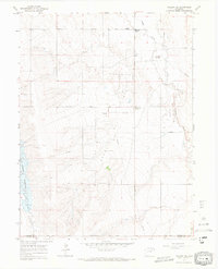
Other maps of this area

1954 · Limon
USGS Topo · 1:250,000

1954 · Sterling
USGS Topo · 1:250,000

1957 · Limon
USGS Topo · 1:250,000

1958 · Limon
USGS Topo · 1:250,000

1958 · Sterling
USGS Topo · 1:250,000

1963 · Lamb
USGS Topo · 1:24,000

1963 · Round Top
USGS Topo · 1:24,000

1963 · Vallery
USGS Topo · 1:24,000

1963 · Adena
USGS Topo · 1:24,000

1965 · Vallery SE
USGS Topo · 1:24,000