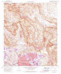
1968 Map of Valley Center
USGS Topo · Published 1988About this map
Escondido and the northern expansion of its suburbs into Rincon Del Diablo highlight the transformation of north San Diego County during the 1960s and 70s. The map illustrates a landscape where established institutions like Palomar Memorial Hospital and Escondido High School anchor a growing residential grid, while recreational spaces such as the Escondido Country Club and the Drive-in Theater reflect the era's suburban shift. To the north, the terrain rises into the Merriam Mountains and Bear Ridge, where the community of Valley Center maintains a more rural character with its eponymous Valley Center School and Valley Center Cemetery. Deep canyons like Moosa Canyon and Reidy Canyon cut through the granite uplands, while Lake Wohlford sits tucked into the eastern hills. This survey documents the intersection of wild land and rapid development, capturing the specific moment when urban purple tint began to creep into the citrus and avocado lands of the interior valley.
Find a feature on this map
42 named features on this map. Tap any name to fly to it.
Don’t see what you’re looking for? This feature index may not catch every label — zoom into the map to look around manually.
Map Details
Editions of this 1968 Valley Center Map
4 editions found
Other maps of this area

1893 · Escondido
USGS Topo · 1:62,500

1901 · Escondido
USGS Topo · 1:62,500

1901 · San Luis Rey
USGS Topo · 1:125,000

1903 · Ramona
USGS Topo · 1:125,000

1904 · Southern California Sheet No. 2
USGS Topo · 1:250,000

1939 · Palomar Mountain
USGS Topo · 1:62,500

1942 · Temecula
USGS Topo · 1:62,500

1942 · Escondido
USGS Topo · 1:62,500

1942 · Ramona
USGS Topo · 1:62,500

1947 · Ramona
USGS Topo · 1:62,500